Read our report on highway mitigation precedents here.
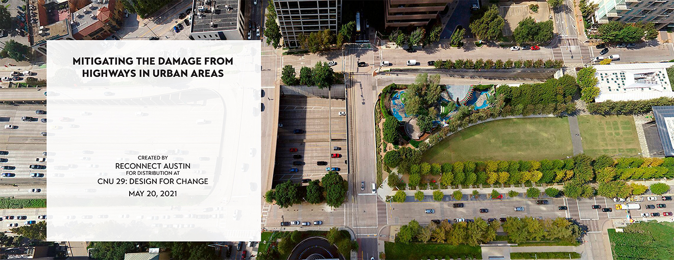
Report by Priya Patel and Addie Walker of Reconnect Austin.
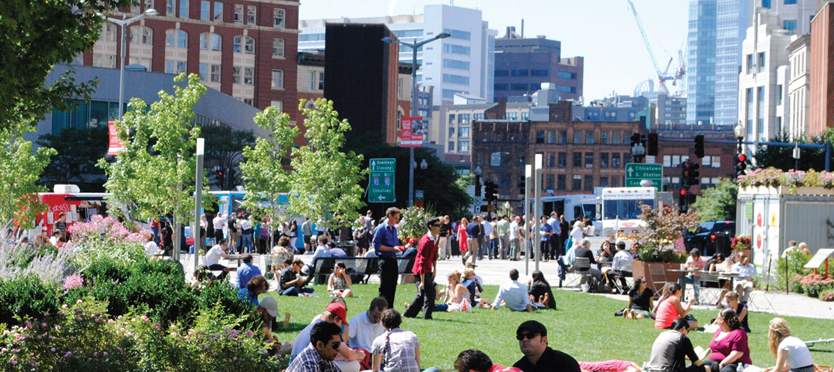
DALLAS TX – KLYDE WARREN PARK
Downtown Dallas’ Klyde Warren Park is the result of a cut-and-cap project on the Woodall Rodgers Freeway, creating new public green space and catalyzing new tax base creation near the park. Funding for the project came from individual donors as well was public support, which included $20 million in bond funds from the City of Dallas, $20 million in highway funds from the state transportation department (TxDOT), and $16.7 million in stimulus funds. Today the park covers 5.2 acres in the heart of downtown and is open to the public; it connects the Arts District to Downtown and Uptown Dallas and is a mix of active and passive pedestrian-oriented space, including a performance pavilion, dog park, children’s playground, and botanical gardens.

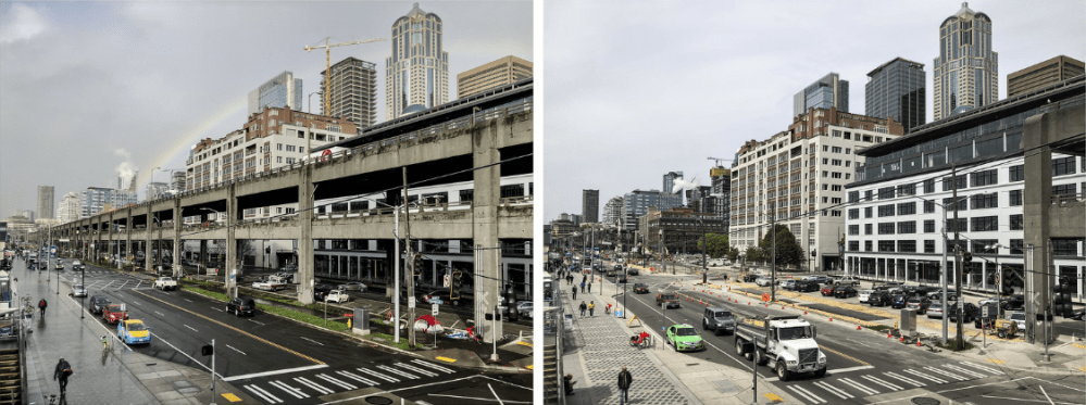
SEATTLE, WA – ALASKAN WAY VIADUCT
Seattle’s Alaskan Way Viaduct was an elevated freeway which ran along Seattle’s downtown waterfront for more than two miles. In 2009, a joint effort between the city of Seattle and the state of Washington agreed to replace the elevated freeway with an underground tunnel, which is designed to carry traffic under downtown. The viaduct was permanently closed; demolition and waterfront development is expected to be completed by 2021. The project is creating new real estate development along the water’s edge, reconnecting the waterfront to downtown Seattle, and opening the area to pedestrian and bicycle travel.

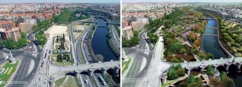
MADRID, SPAIN – RÍO MADRID
In the 1970s, Madrid was cut in half by the construction of the M30 motorway, which ran along the Manzanares river and cut through the center of the city. Between 2006 and 2011, Madrid removed the M30 and various motorways running alongside it from the banks of the river and rerouted traffic into recently constructed underground tunnels. The cleared river banks were turned into a linear park and several new bridges were constructed to connect neighborhoods and park goers on either side of the river. The new Madrid Río is both a well-loved destination and a pedestrian-friendly thoroughfare.
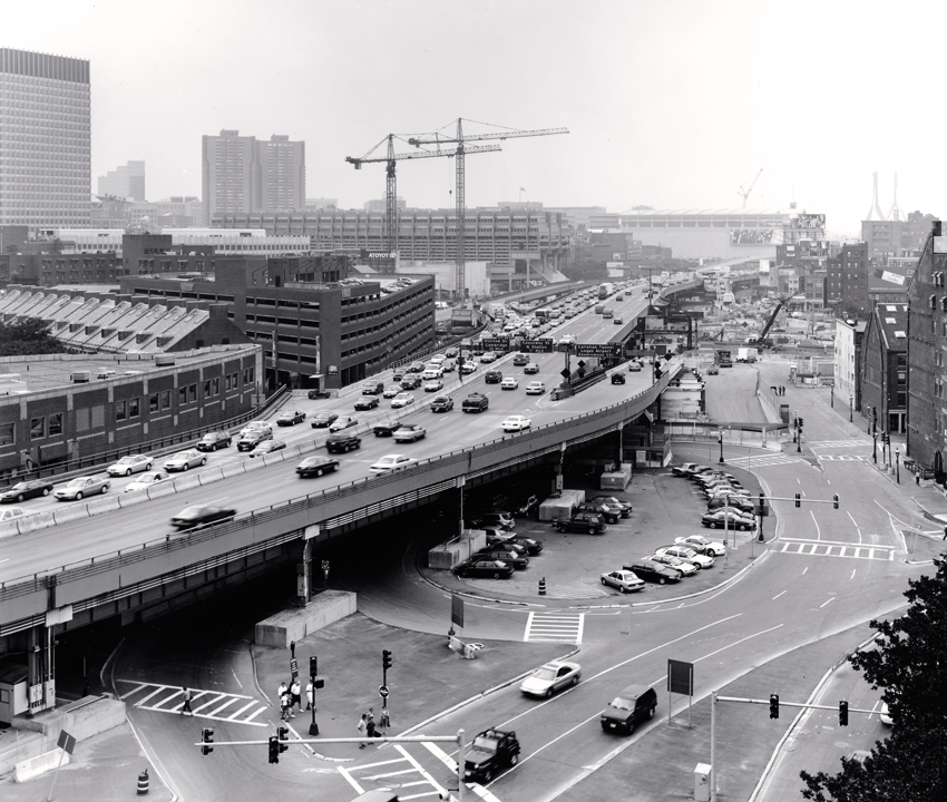
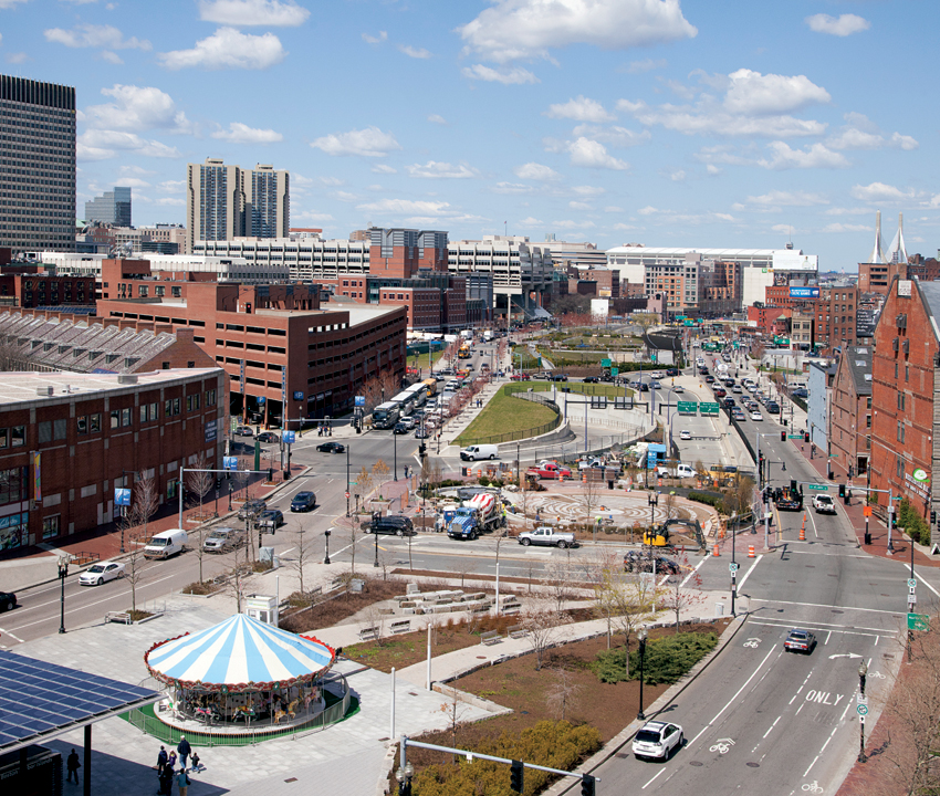
BOSTON, MA – THE BIG DIG
Boston’s Central Artery was an elevated highway built in 1959 that cut off the North End and Waterfront neighborhoods from downtown and, by the mid 1990s, was congested for up to 10 hours a day. Beginning in the 1990s and completed in 2007, the Central Artery was replaced with an underground expressway that followed the route of the original highway, transporting more people and reducing traffic by 62 percent. The elevated Central Artery was demolished and replaced with ground-level boulevard and linear park, successfully reconnecting downtown with its surrounding neighborhoods and reducing both air pollution and traffic congestion through downtown Boston.

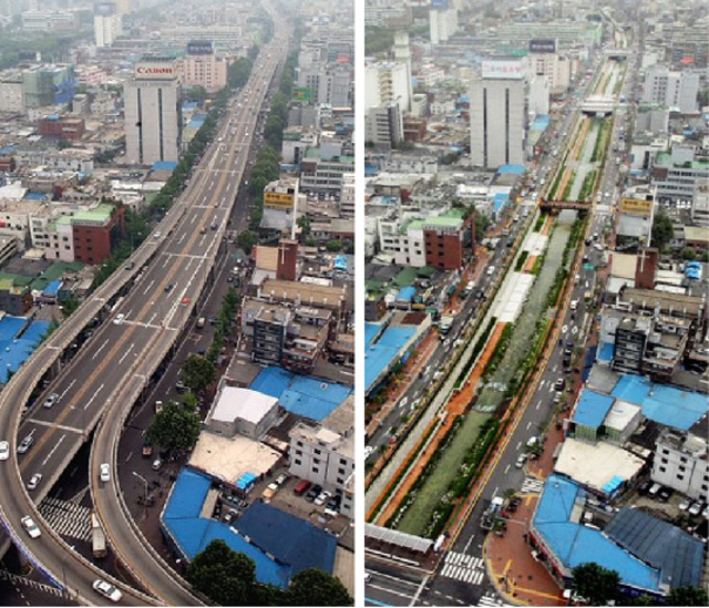
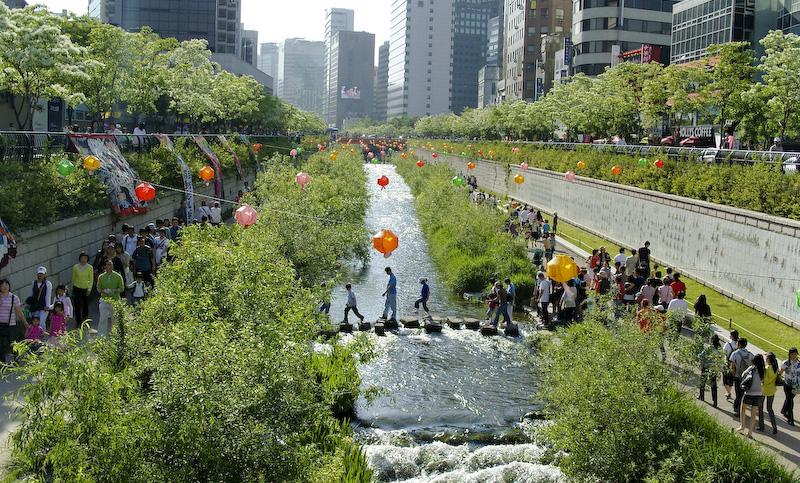
SEOUL, SOUTH KOREA – CHEONGGYECHEON EXPRESSWAY
In the 1950s, the Cheonggyecheon River running through the heart of Seoul was paved over. In the 1970s, an elevated highway was built over it to carry traffic through, but not into, downtown Seoul. In 2001, Mayor Lee Myung-bak was elected on his platform of revitalizing Seoul and transforming it into an urban center of East Asia. The centerpiece of his project saw the Cheonggyecheon Expressway demolished and in its place, where the original Cheonggyecheon River flowed in the 1950s, an artificial creek lined with walkways and green space was constructed, depressed slightly below street level. The road around it is split by the new creek, which offers a peaceful natural setting in a dense urban environment and has also led to a reduction in air pollution, an increase in local flora fauna, and a 3.3 degree Celsius drop in average temperatures for several blocks around the creek. The project was so successful that Lee Myung-bak was elected president of South Korea in 2008 for his work in Seoul, and the new greenway has inspired removal of at least 15 expressways throughout Seoul.
Read more about these and similar projects on the Congress for the New Urbanism’s website.
