In the early 20th century before I-35 was constructed, Austin was racially and economically diverse throughout the city. That changed with the institution of the 1928 City Plan, which forced Black residents of Austin, who previously lived throughout the city and in established Freedmen Communities, into a six square mile “Negro District” in East Austin. East Avenue was the dividing line between the white neighborhoods of downtown Austin and the Black neighborhoods of East Austin.
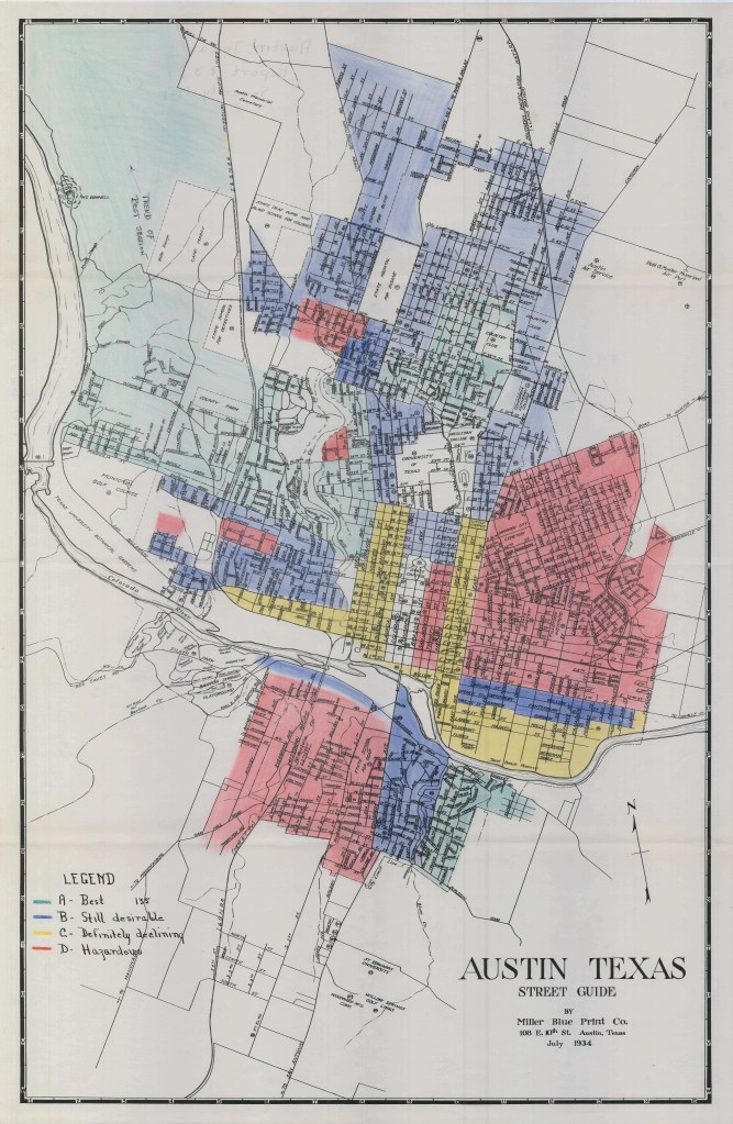
The residential segregation enforced by the 1928 City Plan was made worse by the United States Housing Authority and the Federal Housing Administration. Redlining was prevalent across the country, including in Austin, and led to further segregation of the city and disinvestment in majority Black neighborhoods. Between the 1930s and 1960s, the City utilized zoning to push commercial and industrial uses into majority Black neighborhoods in East Austin.
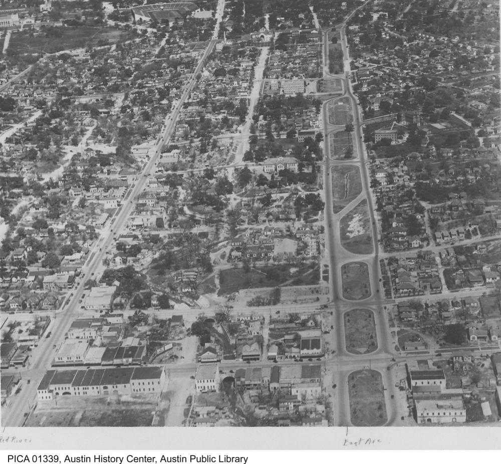
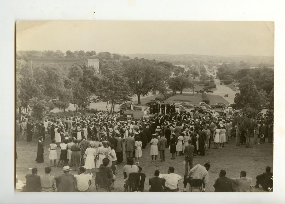
East Avenue, though it functioned as the dividing line between downtown and East Austin, was valuable to the nearby community. The two-way divided street had ultrawide medians and was lined with trees, and served as public green space. Below, Huston College utilizes East Avenue for their convocation ceremony.

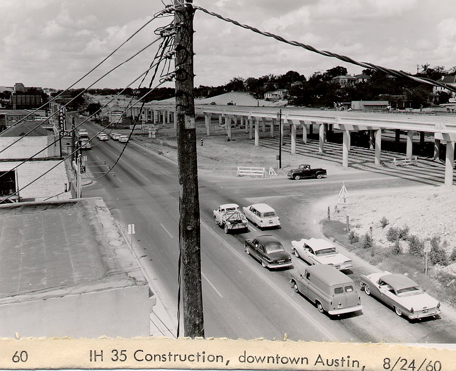
The first highway constructed through East Austin was the Interregional Highway, a precursor to I-35. The Interregional Highway was planned in the 1940s and constructed in the 1950s in hopes of relieving downtown traffic congestion. The highway was built mostly within existing rights-of-way (ROW) and did not require major property acquisitions; it also left parts of East Avenue unchanged.
Not long after its completion, the Interregional Highway was converted into Interstate 35 (I-35). The development of the federal interstate program incentivized cities to build interstates through their urban cores, and by using the existing Interregional Highway ROW, the Texas Highway Department (now the Texas Department of Transportation, TxDOT) was able to save money on construction costs. Construction of I-35 demolished East Avenue and buildings along its east side, including Black-owned homes and businesses. It did not take properties on the west side of the highway, opting to use the existing Interregional Highway footprint for the southbound lanes and expanding east to make way for the northbound lanes. Land was taken from residents in East Austin using eminent domain, which appraised property values below their true worth and forcibly pushed residents out with inadequate compensation for their taken land. The effects of this practice are multigenerational, and there is a growing effort to analyze the magnitude of general wealth lost via eminent domain for highway construction (see ReConnect Rondo’s “Past Prosperity Study.”)
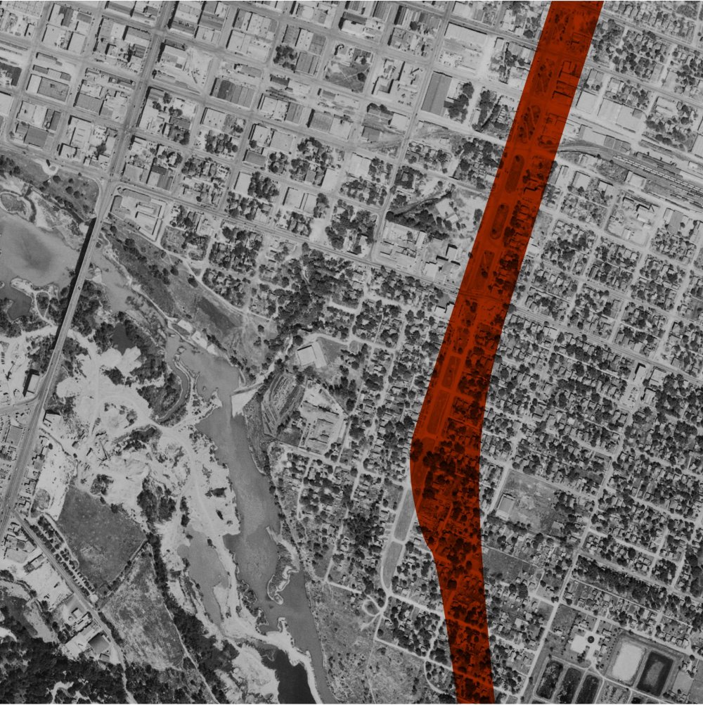
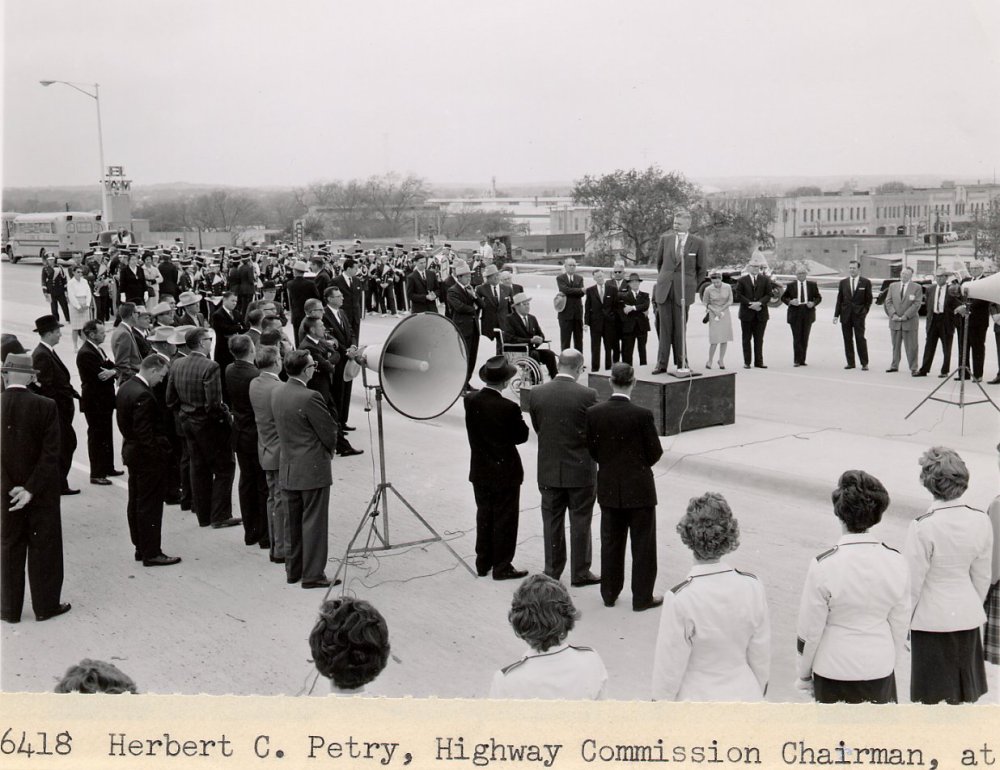
I-35 was completed and dedicated in 1962. It became a visual and physical barrier between downtown and East Austin, solidifying the dividing line that had been East Avenue. It also severely limited East / West connectivity to just a few crossings. It was primarily used by commuters traveling from their suburban homes to and from their downtown jobs. With the increase in vehicular traffic, the streets adjacent to the highway became more commercial, and properties nearby were demolished to create strip malls, gas stations, and parking lots.
I-35 has since been expanded. Today it is one of the most dangerous and congested corridors in Texas. It continues to be a visual and physical barrier between downtown and East Austin, and a huge impediment to connectivity. It cuts through the University of Texas at Austin’s campus, separating students, faculty, and staff from their destinations. Its few East/West connections make traveling difficult for all modes and incentivize using I-35 even for short trips. It is the most dangerous corridor in Austin for traffic fatalities. It contributes to air, water, and noise pollution both adjacent to the corridor and across the region.

And TxDOT plans to expand it once again. Read more about TxDOT’s proposal for I-35 here.
We encourage you to get involved and make your voice heard. Follow us on Twitter and Facebook @ReconnectAustin for project updates and opportunities to get involved.
For more information about redlining, institutional segregation, and the use of zoning to segregate cities, check out Segregated By Design and The Color of Law: A Forgotten History of How Our Government Segregated America by Richard Rothstein.
